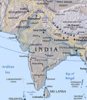
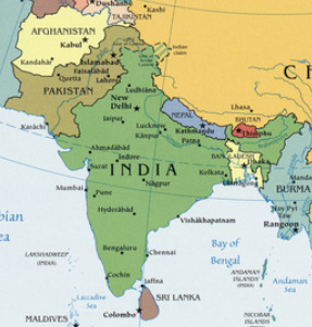
South Asia
There are 8 countries in this region: There are Afghanistan, Bangladesh, Bhutan, India, Maldives, Nepal, Pakistan, And Sri Lanka (Pulsipher & Pulsipher, 2008).
Physical Features
The region is surrounded by the Indian Ocean on the east, west and south and the highest mountain range in the world, the Himalayas, to the north. In the northwestern area of the region lies the Thar Desert which is also known as the Great Indian Desert. It has undulating sand dunes separated by sandy plains and low barren hills that covers nearly 77,000 thousand square miles. The Western and Eastern Ghats are mountain ranges that are in southern India along the east and west coasts. They have a great deal of effect on the rain produced by the monsoons. The Central Makran Range is in southwest Pakistan and is made from limestone and sandstone that was pushed upward when the Indian Plate collided with the Asian Plate. Two of the main rivers in the region are the Indus River and the Ganga River. Both of these rivers have their start in the Himalayas within 100 miles of each other. They go in opposite directions with the Indus moving westward emptying into the Arabian Sea and the Ganga eastward emptying into the Bay of Bengal. The Indus River flows through Pakistan and the Ganga River moves from India and through Bangladesh (Pulsipher & Pulsipher, 2008).
Climate
The climate of the region is dominated by the monsoon winds. During the summer, the heating of the Eurasian land mass pulls moist winds across the Western Ghats and then releasing the rain that supports tropical rain forests and tropical crops on the central uplands. The winds then bring moisture to the Himalayas where the rainfall can exceed 35 feet annually, the most in the world. The moisture may fall as snow in the higher elevations and the melt of this snow feeds the headwaters of all three major water systems in the region. The region has Tropical wet and wet/dry, Desert, Steppe and Sub-Tropical climates which are influenced by the amount of rain received and that is controlled by the monsoons (Pulsipher & Pulsipher, 2008).
Resourses
The region doesn’t have the vast oil reserves of its neighbors and only a limited supply of natural gas. There are mining operations that produce iron ore and precious stones which are exported to help with balance trade with other nations. The area does have a lumber industry, but the clear cutting done has produced negative effects (Pulsipher & Pulsipher, 2008).
Environmental Issues
Deforestation is a problem in the region as the clearing of land is continuing for commercial logging and village expansion. This loss of forests cause massive landslides that increase erosion and the possibility of flooding as the ground can no longer absorb as much of the monsoon rains. Chipko or social forestry movement has spread from its beginning of local women literally hugging trees to stop their being cut down. The movement has had success in slowing the deforestation, but is still is a major problem. There are deputes over water as India diverts sixty percent of the Ganga rivers flow away from Bangladesh, creating environmental issues as salt water moves in from the Bay of Bengal and kills crops. The river is also polluted by industrial wastes and sewage. The region has 20 percent of the world’s population and only 4 percent of the fresh water, so it is critical that the water resources in the region are protected (Pulsipher & Pulsipher, 2008).
Population Patterns
Almost thirty percent of the population of South Asia is urban and it is second only to East Asia as the most densely populated region in the world. The region has four cities that have populations over 13 million people with the largest being Mumbai with 19 million. The cities offer people improved opportunities in work and education and though the conditions are extremely crowded, people continue to migrate to the urban areas. The population growth of South Asia is an issue as it continues at a rate of 1.7 percent. This growth makes increasing demands on educational systems and food reserves as a full one third of the population is less than 15 year of age. One of the issues in controlling the rate is that in poor rural areas, as with similar situations world wide, children are a positive factor in the family economics. Infant mortality in the region is second only to sub-Saharan Africa and this makes families have two to three children just to ensure some make adulthood (Pulsipher & Pulsipher, 2008).
The Role of Gender
Women in this region have a noticeably lower status than do men. The type of religion practiced also plays a role in the lives of women in the area, as Christian and Hindu women can expect a much higher socioeconomic status than can their Muslim counterpoints. In some areas of the region that were under Taliban control, women, and even urban professionals, were required to live in seclusion and were not allowed working outside the home or going to school. The practice of covering women from the eyes of men is practiced in various ways throughout the region from a covering for the hair to complete coverage with not even a face visible. The practice of women’s families paying a dowry to the groom’s family has caused a phenomenon of bride burning which enables the groom to marry again and his family collects another dowry. There are also reports that in low income homes female babies will be killed due to the expense they represent when a dowry is required. The restraints that women face have not stopped a strong activist movement for women to have constitutional protection that is required (Pulsipher & Pulsipher, 2008).
Religions
The major religions in the region are Buddhism, Christianity, Hinduism, Islam, Sikhism, the tribal animism and Jainism. The two major players in the regions power struggles have been Hinduism and Islam. Hinduism is practiced by about 900 million people world wide and of those, 800 million live in India. The religion observed caste identities and these are still observed and cause some dissention in India today. The castes divide society into hierarchical categories in which some are given advantage over others. The government attempted to make quotas for lower castes in order to raise the living standard of lower groups and this was met with protests insisting that abilities should determine opportunities and not quotas. The region is also divided between areas of control by Hindus and areas where Islam is the majority. In some low caste communities, the entire village has converted to Islam in order to escape the caste system. The political division is said to be that India is Hindu and Pakistan is Islam even though both countries are set up as secular states (Pulsipher & Pulsipher, 2008).
Transportation
The region has airlines that service the area and modern airports. There are vast network of roadways but very little of the roads are expressway type. Railroads connect most of the major areas and are used for transporting goods and people, especially when they are on pilgrimages to sacred areas. India has 14,000 miles of navigable water ways within it borders and seven major ocean ports for the export of their products (CIA, 2011).
Country of Focus - Nepal –
Nepal became a federal democratic republic in 2008 and the newly elected Constituent Assembly abolished the monarchy that had been in power. The country’s first president was elected in July of that year. Several coalitions have been formed and dissolved over the last few years and the resignation of the prime minister in June of 2010 led to political gridlock until the election of Jhala Nath KHANAL in February 2011. A new constitution is in the draft stage and is scheduled to be complete this May. The climate of the country varies from the north to the south, with the expected north being colder and south being warmer. The country is on the edge of the Himalayas to the north and with a flat river plain in its southern area. The highest point in the country is also the worlds at the peak of Mt. Everest. There are small deposits of copper, cobalt and iron ore and the terrain provides an excellent place for hydroelectric power. Tourists provide income as well due to the scenic beauty of the country and it access for climbers to Mt. Everest.
Agricultural Production
The majority of the region is adapted to having two crops a year with crops that need dry weather grown in the winter and crops that require moisture are grown during the summer. The two most important crops that are grown in the region are rice and wheat but corn, potatoes, sugarcane, peas and beans, onions and mustard are also grown. In areas that do not have good conditions for growing, animal grazing is an important local activity. A Green Revolution in the 1960’s increased grain harvests by the use of new techniques and fertilizers. The use of these chemicals has the result of creating pollution that previously didn’t exist. The area has started a style of agriculture called agroecology in which natural methods are used to fertilize crops and kill pests. This style is a help to small poorer farmers because the materials are available and inexpensive (Pulsipher & Pulsipher, 2008).
Resources
Central Intelligence Agency (CIA). (2011). India. Retrieved from: https://www.cia.gov/library/publications/the-world-factbook/geos/in.html
Central Intelligence Agency (CIA). (2011). Nepal. Retrieved from: https://www.cia.gov/library/publications/the-world-factbook/geos/np.html
Pulsipher, L. M., and Pulsipher, A. (2008). World Regional Geography: Global Patterns, Local Lives (4th ed.). New York: W. H. Freeman and Company.
The University of Texas at Austin. (2011). [Perry-Castańeda Library digital map collection]. Asia Political 2008. Retrieved from:
http://www.lib.utexas.edu/maps/middle_east_and_asia/txu-oclc-247232986-asia_pol_2008.jpg
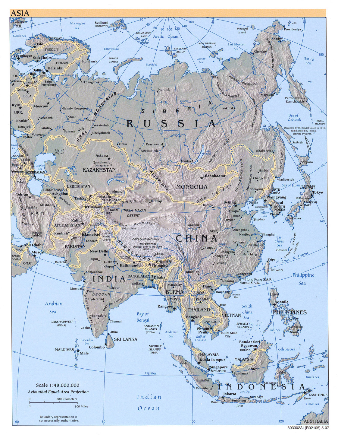
The University of Texas at Austin. (2011). [Perry-Castańeda Library digital map collection]. Asia Reference Map 2007. Retrieved from:
http://www.lib.utexas.edu/maps/middle_east_and_asia/asia_ref_2007.jpg
The University of Texas at Austin. (2011). [Perry-Castańeda Library digital map collection]. Sri Lanka, Shaded Relief Map 2000. Retrieved from:
http://www.lib.utexas.edu/maps/middle_east_and_asia/sri_lanka_rel00.jpg
